

In brief
- U.S. airstrikes hit three Iranian nuclear sites, but verifying uranium destruction is difficult.
- Uranium can’t be seen by satellites, and key site Fordow remains uninspected, according to the International Atomic Energy Agency.
- Remote sensing provides clues, but full verification may require on-site access and diplomatic efforts.
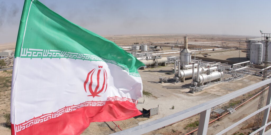
While President Donald Trump has heralded the weekend strike on three Iranian nuclear sites as a success, verifying the destruction of uranium stockpiles in Iran is a challenge for U.S. and international intelligence agencies.
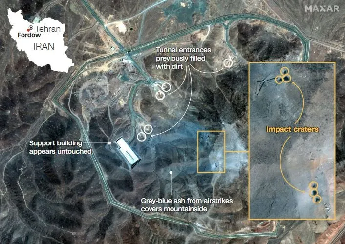
The International Atomic Energy Agency has not been able to inspect the damage to the U.S. military’s main target, the Fordow uranium enrichment facility, which is built deep inside a mountain in central Iran, and thus cannot independently verify Trump’s claim that the site was “obliterated.”
“At this time, no one, including the IAEA, is in a position to have fully assessed the underground damage at Fordow,” Rafael Grossi, Director General of the International Atomic Energy Agency, told Reuters on Monday.
Despite a sophisticated airstrike, at this point, experts say the issue isn’t just what was targeted, but trying to determine if it was destroyed.
“It will take time, intelligence assessments, and satellite imagery to determine the extent of the damage,” Professor of the Practice of International Relations at USC, Jeffrey Fields, told Decrypt. “Once that’s clear, we can evaluate whether we significantly crippled, or destroyed, Iran’s ability to continue enriching uranium.”
While images of explosions may show damage to structures, uranium itself can’t be seen with traditional satellite imagery, and there is no single tool capable of remotely confirming whether it’s been eliminated.
However, several technologies are available that can help analysts build a picture of what happened on the ground.
Radiation detection from drones and aircraft
Specialized aircraft and drones can carry radiation sensors capable of detecting gamma rays or neutrons.
However, these aircraft must fly extremely close to the ground, typically within a few thousandths of a mile, to effectively detect and map radioactive sources, making them vulnerable to attack.
Air sampling and downwind analysis
To detect radioactive releases, the U.S. Air Force operates the WC-135 “Constant Phoenix.”
These fixed-wing aircraft, based on the Boeing 707, are designed to collect atmospheric samples and analyze radioactive isotopes in the event of a nuclear explosion or accidental release, provided the winds carry the particles far enough.
According to the Air Force, the WC-135W played a significant role in tracking radioactive debris from the Chernobyl nuclear plant disaster in 1986.
“During the Cold War, before we understood the environmental damage of above-ground or atmospheric nuclear tests, the U.S. did it, and so did other countries,” Field said. “Those tests released radioactive isotopes into the air, which could be detected. With underground tests, that’s much harder to pick up now.”
Adding to the trouble with detection, Fields said, is the depth of the Fordow facility, which is reportedly 80 to 90 meters, approximately 260 to 295 feet, below ground.
Neutrino detectors
Neutrino Detectors are highly sensitive instruments capable of identifying particles released from nuclear reactions.
While the technology has the potential to provide long-range monitoring, its use is currently mainly experimental.
Neutrino detectors need to be placed relatively close to the source, within about 56 miles, to be effective.
Because of this limitation, the technology is not widely used for real-time monitoring.
Hyperspectral imaging and indirect clues
Satellites and drones equipped with hyperspectral sensors cannot directly detect uranium, but they can identify indirect signs of activity, such as heat signatures, disturbed terrain, or camouflage patterns.
These clues may suggest that a facility was struck or damaged, though they can’t confirm what was inside.
When combined with machine learning and artificial intelligence, hyperspectral imagery and other remote sensing data can help detect changes to structures or vehicles that may indicate blast effects at a facility.
However, these technologies still cannot confirm the presence or destruction of uranium itself.
The limits of technology
While tools like AI and satellite imagery may aid military leaders in determining the accuracy of the hit on the target, verifying if Iran’s nuclear capabilities have been destroyed may require an on-the-ground investigation.
“We need to try to go back to the negotiating table as soon as possible. We have to allow the IAEA inspectors to return,” Grossi said in a statement. “The IAEA is ready to play its indispensable role in this process.”
“We have been talking to Iran, we have been talking to the United States,” he added. “We have to work for peace.”
Edited by Josh Quittner and Sebastian Sinclair
Generally Intelligent Newsletter
A weekly AI journey narrated by Gen, a generative AI model.